17th Century World Map Silk Tie
17th Century World Map Silk Tie
SKU:LST-017
Verfügbarkeit für Abholungen konnte nicht geladen werden
LAST CHANCE
A final opportunity for you to claim a piece of style history with an end-of-line, or one-off sample before they vanish forever.
DESIGNER'S NOTES
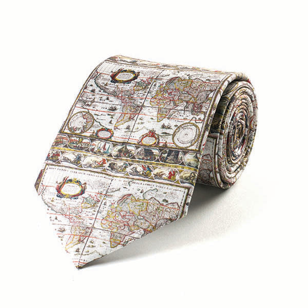
A Fox & Chave silk tie featuring a design from elements of an early 17th century map of the world.
Seventeenth-century cartography saw significant advances in the accuracy, detail, and decorative quality of world maps, driven by exploration, trade, and scientific inquiry. Mapmakers such as Willem Blaeu, Johannes Janssonius, and Gerard Mercator combined careful observation with artistic flourish, producing maps that were both practical and visually striking.
These maps often included elaborate cartouches, sea monsters, ships, and compass roses, reflecting the era’s blend of science, mythology, and aesthetics. Improved surveying techniques and navigation allowed more precise coastlines, while global trade routes and colonial ambitions influenced map content.
The period marked a transition from symbolic medieval maps to empirical, geographically informed representations, where beauty and utility coexisted, making maps objects of both knowledge and decorative art.
STYLING
A Fox & Chave silk tie looks best tied in a classic Windsor or half-Windsor knot and worn with a collar style of your choosing. Cutaway or spread collars offer the greatest opportunity to display the detail of your unique silk tie design.
- Length: 150 cm
- Width: 9,5 cm
- Dry clean only
- 100% Silk Twill
- Hand Finished
- Made in China
Share